
They called it Southie. Not on any T map. But for a hundred and fifty years, if you were Irish in Boston, this peninsula was where you landed. By the First World War South Boston held more than 70,000 people, eleven chapters of the Ancient Order of Hibernians, and six Catholic parishes anchoring tight grids of three-deckers. When the school buses came over the bridges in 1974, some of the residents on the rooftops compared what they were watching to the British occupation of the North.
South Boston, The Place
South Boston sits on a peninsula east of downtown, jutting into the harbour with Dorchester Bay to the south and the Reserved Channel to the north. The MBTA Red Line runs underneath it: Andrew Square at the bottom, Broadway in the middle. Broadway itself, split into East and West, is the spine of the neighbourhood. Locals divide the place in two: the Lower End (the western half, closer to the bridges and the old factories) and City Point (the eastern half, ending at Castle Island and the open water). The housing is mostly brick and clapboard three-deckers, packed shoulder-to-shoulder on numbered cross-streets, A through P running east, laid out like a port town that never quite stopped being one.
How South Boston Became Irish
Before the Irish
The peninsula was Mattapannock to the Massachusett tribe and Dorchester Neck to the Puritans who arrived in 1635 and used it as grazing land for the next century and a half.
South Boston’s pivotal moment came on March 17, 1776, when Continental forces under George Washington fortified Dorchester Heights overnight, putting cannons within range of the British fleet in the harbour. The British evacuated the next morning. Bostonians have called it Evacuation Day ever since, and the date, by sheer coincidence, lined up perfectly with St. Patrick’s Day.
The peninsula was annexed by Boston in 1804, and two bridges were thrown across the channel to the South End. Within a generation, glassworks, foundries, machine shops, and chemical plants had filled the lowlands near the bridges.
The neighbourhood needed labour. The labour, when it came, came from Ireland.
The Irish Arrive
The first Irish to arrive in South Boston in the 1820s and 1830s were skilled tradesmen and small business owners: masons, ironworkers, shopkeepers drawn by the new industries.
Then came the Famine. Between 1846 and 1852, the potato crop failed across Ireland and roughly a million people died of starvation and disease. Another million emigrated, and Boston was one of the closest North Atlantic ports.
The Irish who came during and after the Famine were not the skilled artisans of the earlier wave. They were destitute farm labourers, mostly from the southwestern counties of Cork, Galway, Kerry, and Clare, and they took whatever work the docks and factories would give them.
They settled in the Lower End, in the cheap blocks between A and F Streets, in tenements that were notoriously overcrowded even by nineteenth-century standards. In 1872, the Great Fire of Boston tore through the Fort Hill neighbourhood downtown, and the Irish who had been living there flooded across the bridges into Southie.
By the end of the century, the neighbourhood was unmistakably Irish: Catholic, working-class, and politically wired in.
South Boston at Its Peak
By the First World War, South Boston held about 70,000 people in roughly the same physical footprint it occupies today. That is more than double the current population of 33,688.
Every few blocks anchored a parish: Saints Peter and Paul on Broadway (1845), Gate of Heaven on East Fourth Street (1863), St. Vincent (1874), Our Lady of the Rosary (1884), St. Monica (1907), and St. Brigid on East Broadway (1908). Eleven chapters of the Ancient Order of Hibernians ran social, charitable, and burial-society work out of meeting halls scattered across the neighbourhood.
The L Street Bathhouse on the southern shore became famous for the L Street Brownies, the year-round swimmers organised in 1902, and the bathhouse itself functioned as something close to a Southie men’s club.
Politically, Southie produced more national power per square mile than almost anywhere in the city.
John W. McCormack, born here in 1891, sat in the U.S. House from 1928 to 1971 and served as Speaker from 1962. Joe Moakley, also a Southie native, represented the district for three decades and chaired the House Rules Committee.
Ray Flynn, a Southie kid who’d played basketball at Providence College, became Boston’s mayor from 1984 to 1993, the first mayor actually from South Boston, and then U.S. Ambassador to the Holy See. William M. Bulger ran the Massachusetts Senate as its President for seventeen years and then the University of Massachusetts.
The neighbourhood’s politicians shared the surname patterns of their constituents: Lyons, Hynes, Moakley, McCormack, Flynn, Bulger. The neighbourhood gave them, in return, a near-unbreakable loyalty.
The Change
Two things broke Southie’s Irish dominance, and they happened in roughly the same decade.
The first was Judge W. Arthur Garrity’s June 1974 desegregation order, which required Boston Public Schools to bus Black children from Roxbury into South Boston High and Southie kids out to Roxbury. What followed was three years of riots, rock-throwing, helicopters over the rooftops, and police snipers stationed on the school building.
Some of the Irish in Southie compared what they were watching to British soldiers in the North of Ireland. Others simply pulled their kids out of the public schools and never sent them back.
Whitey Bulger, William Bulger’s older brother and the de facto boss of Southie’s organised crime, used the siege mentality to consolidate his control over the neighbourhood. By the time the federal court released the schools from oversight in 1988, an entire generation of Southie kids had been ground through it.
The second change was slower and arrived from the opposite direction: real estate. Through the 1990s and 2000s, the old waterfront warehouses east of the Fort Point Channel were rebranded as the Seaport District. By 2014 it was, by some measures, the fastest-growing real estate market in the country, and the spillover swallowed Southie.
Triple-deckers that had passed from grandparent to grandchild for a century started selling to young professionals at prices working families couldn’t match.
By the 2020 Census, South Boston was 79% white, but only a fraction of those were the old Southie Irish. Many had moved out to Quincy, Milton, Weymouth, and the South Shore towns where their grandchildren could afford a yard.
The Landmarks of Irish South Boston
Gate of Heaven Church, 615 East Fourth Street. Founded in 1863 during the parish’s first wave of Famine refugees, Gate of Heaven became the spiritual centre of City Point and the wedding-and-funeral church of choice for the families who’d “moved up” from the Lower End. It still operates today, paired now with neighbouring St. Brigid as a single combined parish. The merger is a quiet sign of how much smaller the practising Catholic community has become.
Saints Peter and Paul, West Broadway. South Boston’s first Catholic parish, opened in 1845 right as the Famine was beginning. For decades it was where the newest arrivals presented themselves on their first Sunday in America. The original building is long gone, but the parish name still anchors the neighbourhood’s institutional memory.
The L Street Bathhouse (Curley Community Center), L Street and Day Boulevard. The city built the first bathhouse on this site in 1866 so that tenement families with no plumbing could wash. Mayor James Michael Curley rebuilt the structure in 1931, and the building has carried his name in the city register ever since. It is home to the L Street Brownies, the swim club organised in 1902 whose New Year’s Day plunge, first staged on January 1, 1904, has become one of Southie’s most televised rituals.
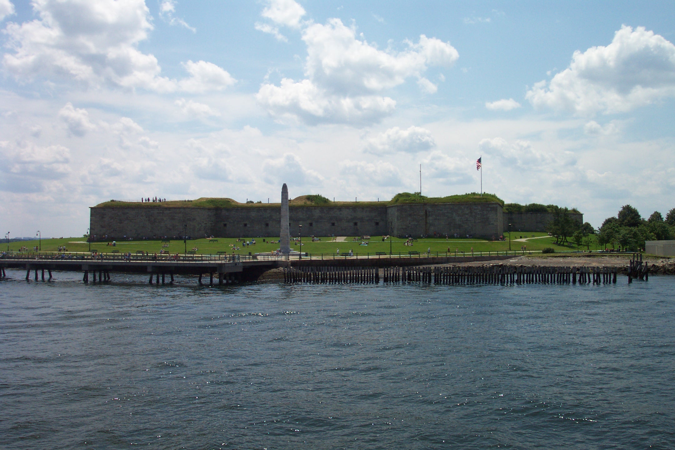
Castle Island and Fort Independence, Day Boulevard. The granite star fort at the tip of the peninsula was begun in 1833 and finished in 1851, but the site has been fortified since 1634. Generations of Southie kids learned to fish off the seawall, and the loop around the harbour is still the most-walked mile in the neighbourhood. On a clear summer evening the ferries to Provincetown pass close enough to wave at.
Sullivan’s at Castle Island, Day Boulevard. Brendan Sullivan opened the first stand in 1951; three generations of the family have run it since. The hot dogs, fried clams, and lemonade in paper cups are not the point. The point is who’s working the windows and who’s standing at the picnic tables on a summer evening. In 2025 the James Beard Foundation gave Sullivan’s its America’s Classics award, formal recognition of something Southie had known for seventy-four years.
The St. Patrick’s Day and Evacuation Day Parade, Broadway end to end. The first South Boston parade marched in 1901, picking up a holiday the city had been celebrating downtown since 1737. It runs every March (excepting 1994 and the pandemic years 2020 and 2021), organised since 1947 by the South Boston Allied War Veterans Council. The route slides east along Broadway through the old parish belt, past where Gate of Heaven and St. Brigid stand and Saints Peter and Paul used to, and finishes near Andrew Square in the Lower End.
Where the Southie Irish Came From
The Famine emigration that built South Boston was overwhelmingly a southwestern Irish story. County Cork sent the largest single contingent, followed by Galway, Kerry, and Clare: the counties hardest hit when the potato blight arrived in 1845 and the counties with the cheapest passage to North America.
Between 1851 and 1854, Cork, Galway, and Donegal ranked among the top counties supplying emigrants to the United States. From County Galway alone, more than 229,000 people left between 1851 and 1914.
The mechanism that kept the flow moving was the prepaid passage ticket. Between 1845 and 1854 alone, Irish-Americans sent about $19 million worth of remittances back across the Atlantic, much of it specifically to bring out a younger brother, a sister, a fiancée.
In the half-century after the Famine, Irish emigrants in cities like Boston were sending home roughly £1 million a year. Southie was built, in a real material sense, on those small, repeated cash transfers. Each one was a promise that the next person in the family wouldn’t have to make the trip alone.
South Boston Today
The neighbourhood is not what it was, and the people who grew up there will tell you that with a directness that has nothing nostalgic in it.
The Seaport keeps spreading west. The triple-deckers keep changing hands. The parishes have been merged or shuttered. The demographic centre of Irish Boston has migrated south, to towns like Quincy, Milton, Braintree, and Weymouth.
The 2020 Census found 33,688 people in South Boston, 79% white. But the overlap between “white” and “Irish-American” is much smaller now than it was a generation ago.
The L Street Bathhouse still opens on New Year’s morning. Sullivan’s at Castle Island still sells hot dogs in waxed paper. The parade still steps off in March. Gate of Heaven and St. Brigid still ring their bells on Sunday.
There are Southie families on their fifth and sixth generation in the same block, and there are Southie kids whose grandparents have never set foot on the peninsula. Both are part of the place now.
The story of how the Irish made a home here is, increasingly, a story whose carriers are spread thin across the suburbs, the South Shore, and the wider world.
Frequently Asked Questions
Why did the Irish settle in South Boston?
The Irish settled in South Boston starting in the 1820s because the newly industrialised lowlands of the peninsula needed cheap labour. Glassworks, foundries, chemical plants, and the docks were all hiring, and the bridges to the South End made the neighbourhood easy to reach. After the Great Famine of 1846 to 1852, tens of thousands of refugees from County Cork, Galway, Kerry, and Clare settled in the Lower End between A and F Streets, where rents were lowest and dockwork was always available.
Is South Boston still Irish today?
South Boston is no longer the majority-Irish neighbourhood it was for most of the twentieth century. Gentrification, the Seaport build-out, and a generational migration to the suburbs have transformed the demographic, and many of the families who built Southie now live in Quincy, Milton, Weymouth, and other South Shore towns. Irish-American institutions still operate: the parishes, the St. Patrick’s Day parade, the L Street Bathhouse, Sullivan’s at Castle Island. But the day-to-day population is now a mix of young professionals, longtime Southie families, and newcomers.
What are the most famous Irish landmarks in South Boston?
The best-known Irish landmarks of the Irish in South Boston are Gate of Heaven Church (615 East Fourth Street, founded 1863), St. Brigid of Kildare on East Broadway (1908), Castle Island and Fort Independence at the tip of the peninsula, Sullivan’s at Castle Island (open since 1951), and the L Street Bathhouse, home of the L Street Brownies New Year’s swim. The annual St. Patrick’s Day and Evacuation Day Parade along Broadway, organised since 1947 by the South Boston Allied War Veterans Council, is the largest single Irish-American event in the city.
Where in Ireland did the Southie Irish come from?
The Southie Irish came overwhelmingly from the southwestern counties of Ireland, chiefly Cork, Galway, Kerry, and Clare. Donegal also sent a large share during and after the Great Famine of 1846 to 1852. The pattern was driven by chain migration. Between 1845 and 1854, Irish-Americans in cities like Boston sent home roughly $19 million in remittances and prepaid passage tickets, most of it earmarked to bring out a specific relative.
When did Irish immigrants first arrive in South Boston?
Irish immigrants began arriving in South Boston in the 1820s, drawn by the new industries that had grown up along the bridges to the South End. The decisive wave came with the Great Famine between 1846 and 1852, when impoverished refugees settled in the Lower End and turned South Boston into a predominantly Irish neighbourhood. A second surge followed the Great Fire of Boston in 1872, when Irish families burned out of the Fort Hill neighbourhood downtown crossed over into Southie.
If your family’s story passed through South Boston, or any of the places the Irish made home in the long century after the Famine, Atlas of Home can trace that journey. From County Cork to East Fourth Street, from a townland in Galway to a triple-decker on Telegraph Hill, to wherever you are now.